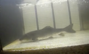
Alewife
Alosa pseudoharengus
Alewives migrate into the Connecticut River and its lower tributaries each spring, moving to the slow waters and ponds where they will spawn between March and June. Their upstream migration does not reach into Massachusetts waters.
Overview
Alewives are an anadromous species that spend the majority of their adult lives at sea, only returning to freshwater to spawn. They are close relatives of blueback herring and difficult to distinguish from them. Alewives are lighter in color and have larger eyes than blueback herrings. They migrate into the Connecticut River and its lower tributaries each spring, moving to the slow waters and ponds where they will spawn between March and June. Their upstream migration does not reach into Massachusetts waters. Mature alewife (ages 3-8) migrate rapidly downstream after spawning. Juveniles remain in tidal freshwater nursery areas in spring and summer.
Like their blueback herring counterparts, alewives are experiencing steep declines. Though dam removals, fishways and other restoration projects have opened some of their historic spawning habitat, alewife populations have been damaged by overfishing, pollution, and spikes in predatory fish populations.
Fish Facts
- Species type Anadromous
- Size Up to 1.5 feet long
-
Conservation
High concern
A species of high concern is one that has been evaluated to be at risk of extinction or elimination fie to restricted range, few populations or occurrences, recent and widespread declines, severe threats or other factors.
- Migration period March – June
- Where to see them Rogers Lake, Mary Steube, Moulson Pond, StanChem dam, Rainbow dam and Easthampton dam
2026 Alewife Passage Counts
When reviewing this chart, please note that alewife fishway counts at the various dams have been inconsistent from year to year. Fisheries biologists are working on refining the data for a more accurate representation of alewife migration.
Fun fact!
Alewife spawn in rivers, lakes, and tributaries from northeastern Newfoundland to South Carolina, but are most abundant in the Mid-Atlantic and the Northeast.
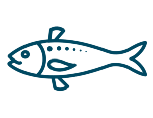
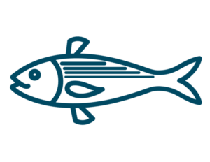
What do they look like?
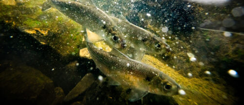
Alewives have an overall silvery color with a grayish green back. They can be recognized by a black spot directly behind their head at eye level. Adults have longitudinal lines that run along the midline of their body. Adult alewives have a golden cast on their heads and upper parts.
-
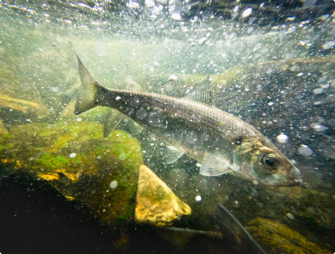 Photo credit: Chesapeake Bay Program under CC 2.0 License
 -
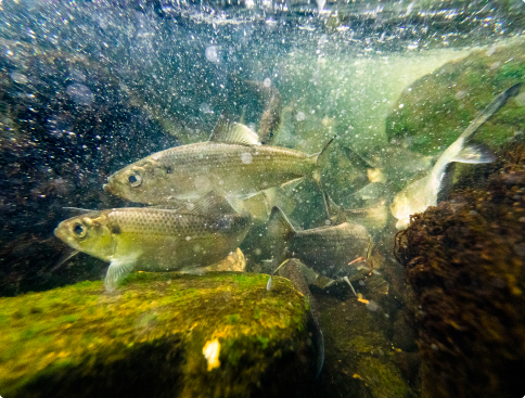 Photo credit: Chesapeake Bay Program under CC 2.0 License
 -
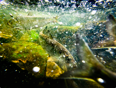 Photo credit: Chesapeake Bay Program under CC 2.0 License
 -
 Photo credit: Chesapeake Bay Program under CC 2.0 License
Where and when can I see them?
Visit Alewives from March to June at these dams:
Rogers Lake
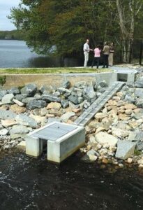
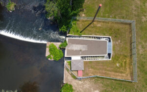
About the facility
The construction of the Rogers Lake fish passage facility in 2014 enabled the return of migratory fish to Rogers Lake in Old Lyme for the first time in several hundreds of years. The new ladder at Rogers Lake was part of a larger project to restore the concrete dam at the lake and was a partnership between the town, Connecticut Department of Energy and Environmental Protection (CT DEEP) and the Connecticut River Conservancy. The addition of the ladder created passage up the Mill River and opened up spawning habitat.
Who passes through this dam?
When do fish migrate?
Upstream
How are they moving?
At the Rogers Lake facility, fish move upstream by using the 20-foot fish ladder. With stepped pools of flowing water, fish can hop up the ladder from the base of the barrier to the waters behind. To move downstream, fish at this site go over the dam spillway.
Where and when can I see them?
The fish ladder at Rogers Lake does not have specific viewing hours. When in operation, the public can view fish using the ladder by visiting Rogers Lake. There is no cost of admission. The fish ladder is located at the following address:
Rogers Lake Dam
Old Lyme, CT 06371
Mary Steube
About the facility
There is a fish ladder on the property next to the dam on Lower Mill Pond. The fish ladder was built in 1998 through a cooperative effort between the Connecticut Department of Energy and Environmental Protection (CT DEEP) and the Old Lyme Land Trust. The fish and eel ladder operation is monitored by the CT DEEP, which issues weekly fish count reports during the fish run season. The fish ladder has a viewing window where it’s possible to see the fish go up the ladder. There is a fish counter on the ladder to keep track of the number of fish using it.
Who passes through this dam?
When do fish migrate?
Upstream
How are they moving?
At the Mary Steube facility, fish move upstream by using the fish ladder. With stepped pools of flowing water, fish can hop up the ladder from the base of the barrier to the waters behind. At this site there is also an eel ladder. The eel wrap around the pegs as they move upward. Unlike the fish ladder, the eel ladder does not span the height of the dam. The eel drop into a bucket after traversing the ladder and are deposited in the pond by DEP staff. To move downstream, fish at this site go over the dam spillway.
Where and when can I see them?
The Mary Steube fish ladder does not have specific viewing hours. When in operation, the public can view fish using the ladder by visiting the Griswold Preserve. There is no cost of admission. The fish ladder is located at the following address:
Mary Steube
30 Boston Post Road
Old Lyme, CT 06371
Moulson Pond
About the facility
The Moulson Pond Fishway on the Eightmile River has successfully provided passage for migrating fish and eels around the old mill dam for many years. Since 1998, when the fishway was installed, thousands of fish have been observed passing around the dam to swim upstream to their ancestral spawning grounds. Since 2015, a newly installed camera has been able to give Connecticut Department of Energy and Environmental Protection (CT DEEP) an accurate count of the fish that traveled this way. The fish ladder operation is monitored by the CT DEEP, which issues weekly fish count reports during the fish run season.
Who passes through this dam?
When do fish migrate?
Upstream
How are they moving?
At the Moulson Pond facility, fish move upstream by using the fish ladder. With stepped pools of flowing water, fish can hop up the ladder from the base of the barrier to the waters behind. To move downstream, fish at this site go over the dam spillway.
Where and when can I see them?
The Moulson Pond ladder does not have specific viewing hours. When in operation, the public can view fish using the ladder by visiting the fishway. There is no cost of admission. The fish ladder is located at the following address:
Moulson Pond
26-2 Mt Archer Rd
Lyme, CT 06371
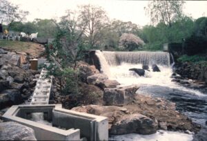
StanChem Dam
About the facility
The StanChem fish ladder was built in 2013 to allow fish to swim upstream around the dam that was built in 1900. The passageway opened the upper 15 miles of the Mattabesset River to native migratory fish populations. The fishway, built in partnership with property owner Stanchem Corp and several nature advocacy non-profits, is on Stanchem property in the East Berlin section of Berlin. The fish ladder operation is monitored by the Connecticut Department of Energy and Environmental Protection (CT DEEP), which issues weekly fish count reports during the fish run season.
Who passes through this dam?


When do fish migrate?
Upstream
Downstream
How are they moving?
At the StanChem Dam, fish move upstream by using the fish ladder. With stepped pools of flowing water, fish can hop up the ladder from the base of the barrier to the waters behind. To move downstream, fish at this site go over the dam spillway.
Where and when can I see them?
The StanChem Dam fish ladder is not open to the public. The fish ladder is located at the following address:
StanChem Dam
401 Berlin St
Berlin, CT 06023